GPS Tracking Systems
GPS tracking systems are connected to satellite navigation system that receives data from satellites in space. GPS tracking systems can be used for vehicle tracking, fleet management, assets security, personal safety and more. The basic use for GPS tracking systems is for the customer to set and receive real-time step-by-step directions.
GPS tracking systems use the principles of both time and location to provide data points for the user. The GPS signals are transmitted from a device and the time and location data is sent to the satellite. The GPS tracking information is processed and then sent to a data center for storage.
The Dynakode GPS monitoring platform allows you to track from 2 to 5000 users with a single, intuitive control panel. If you have ever used Google Maps, then you will be comfortable with the GPS platform usage.
In the case of GPS tracking, the data is sent to our servers and then translated into meaningful and money-saving reports. Data on our servers is stored from the time you begin tracking with us and is never erased.
Keep Track of Your Loved One’s (Personal Safety)
Dynakode GPS Tracking Systems are perfect for dynamic families with school-aged children, elders or seniors, pets who occasionally get loose, and drivers who may need monitoring. It’s all about having peace of mind when you are not around them.
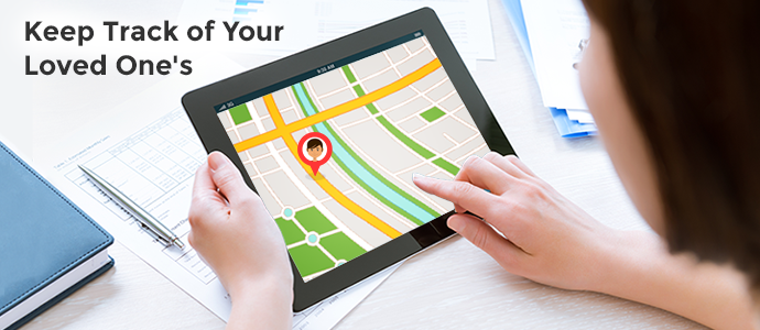
Stop worrying about your children’s college road trip, elder one’s at home and your ladies out for work or shopping. Dynacare tracks your elderly relatives or those with special needs. Knowing where your loved ones are will help you keep them safe from any harm.
Dynacare is one of our most suited product in the consumer range of products. Some models even come with a built-in panic button. All they have to do is press it and help will be on the way in seconds.

Dynacare features:-
- Simple to use
- Low battery alerts
- 2-way communication
- Equipped with emergency reporting
- Configurable SOS recipient numbers
GPS Tracking Systems for Emergencies
GPS has played a vital role in rescue operations for global disasters such as the Tsunami, Hurricanes, Earthquakes and many other. The Global Positioning System (GPS) serves as a facilitating technology in approaching these needs.

Another important area of disaster relief can be at the time of wildfires. To manage forest fires, aircraft are combined with GPS trackers with scanners to identify the fire boundaries and “hot spots.” Within minutes, fire maps are transmitted to a portable field computer at the firefighters’ camp. Armed with this information, firefighters have a greater chance of winning the battle against the firestorm.
GPS tracking systems had become an essential part of modern emergency response systems — whether helping stranded motorists find assistance or guiding emergency vehicles.
The modifications of GPS tracking systems will further facilitate disaster relief and public safety services. In short, GPS modernization translates to more lives saved and faster recovery for victims of global tragedies.